
The BRAP was designed as a scenic adventure tour of the Cumberland Plateau and bluegrass region of Kentucky. The 600-mile loop was also designed as a feeder route for the Southern Ohio Adventure Loop (SOAL) and the Great Ohio Adventure Tour (GOAT) in Ohio, connecting those routes to the Daniel Boone Backcountry Byway (DBBB) and Kentucky Adventure Tour (KAT) in Frenchburg/Slade. The BRAP was designed and scouted counter-clockwise and the descriptions below are written in that fashion, however, the route can be ridden in either direction.
Section 1 – 96 miles

Section 1 starts from the Marathon station in South Portsmouth on KY-8 and winds southwest through the Greenup County hollers before bending north up to Vanceburg for gas. This section of the BRAP arguably rivals section 6 for the most off-tarmac portions of the route. In this section, folks will pass through remote Appalachian backcountry, pass Boone Iron Furnace, and feel the remoteness of Saylor Branch Creek.
Section 2 – 96 miles
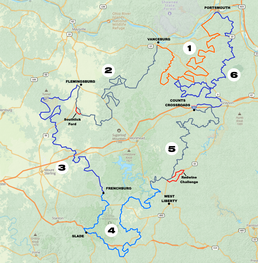
Section 2 starts at another Sunoco Vanceburg along KY-9, AA Highway, and heads south out of the Cumberland Plateau and into the bluegrass region and ending in Flemingsburg. Section 2 features similar gravel roads through forgotten hollers, an “intermediate” section along “Hardy Fork,” which also includes a modern (private) covered bridge. The route then transitions into the rolling bluegrass hills, passing three more historic covered bridges, and a healthy serving of Kentucky Amish country. As an aside, Kentucky only has 12 remaining historic bridges still standing, 3 of which are on this section. South Lick Ford, the first “Challenge” section, is near the end of section 2, just before heading north into Flemingsburg. The roads in and out of this section are not difficult, however, the water crossing is particularly deep after spring rains, and the bottom is lined with a series of very large rocks, exercise extreme caution if you attempt the fording the creek (note, the rocks to the north are extremely slippery as well).
Section 3 – 98 miles
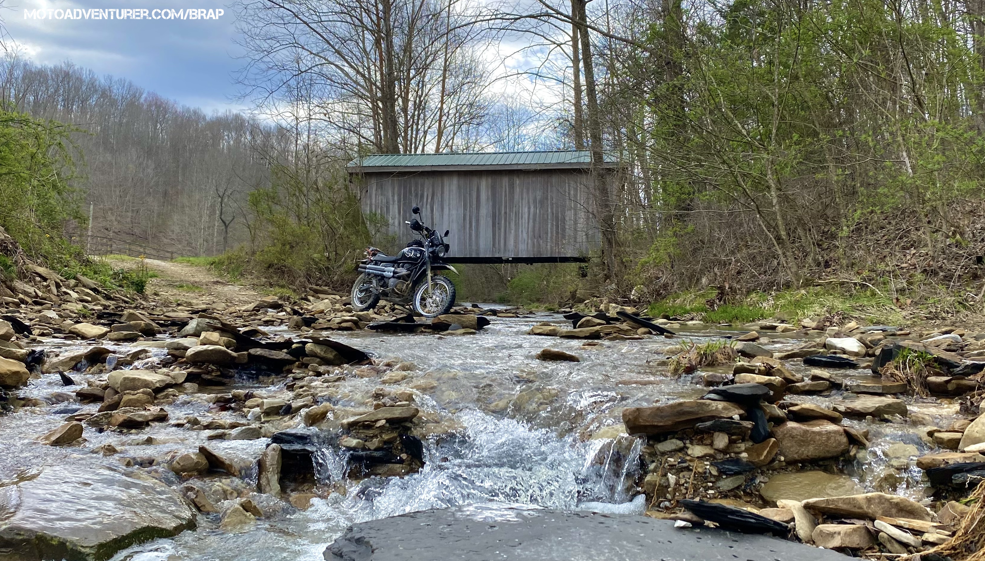
Section 3 starts at a Shell station in west Flemingsburg and works its way southeast down toward Frenchburg. This section is the heart of the bluegrass region and includes very healthy portions of Amish country. Section 3 includes a few lengthy sections of gravel along lonely creeks, but the amount of pavement commutes between off-road sections increases. The Bourbon Ironworks is the historic highlight of this section. “The Old Thunder Mill” as it was called supplied cannonballs to U.S. troops during the War of 1812. General Andrew Jackson said those supplies were imperative to their victory at the Battle of New Orleans.
Section 4 – 98 miles
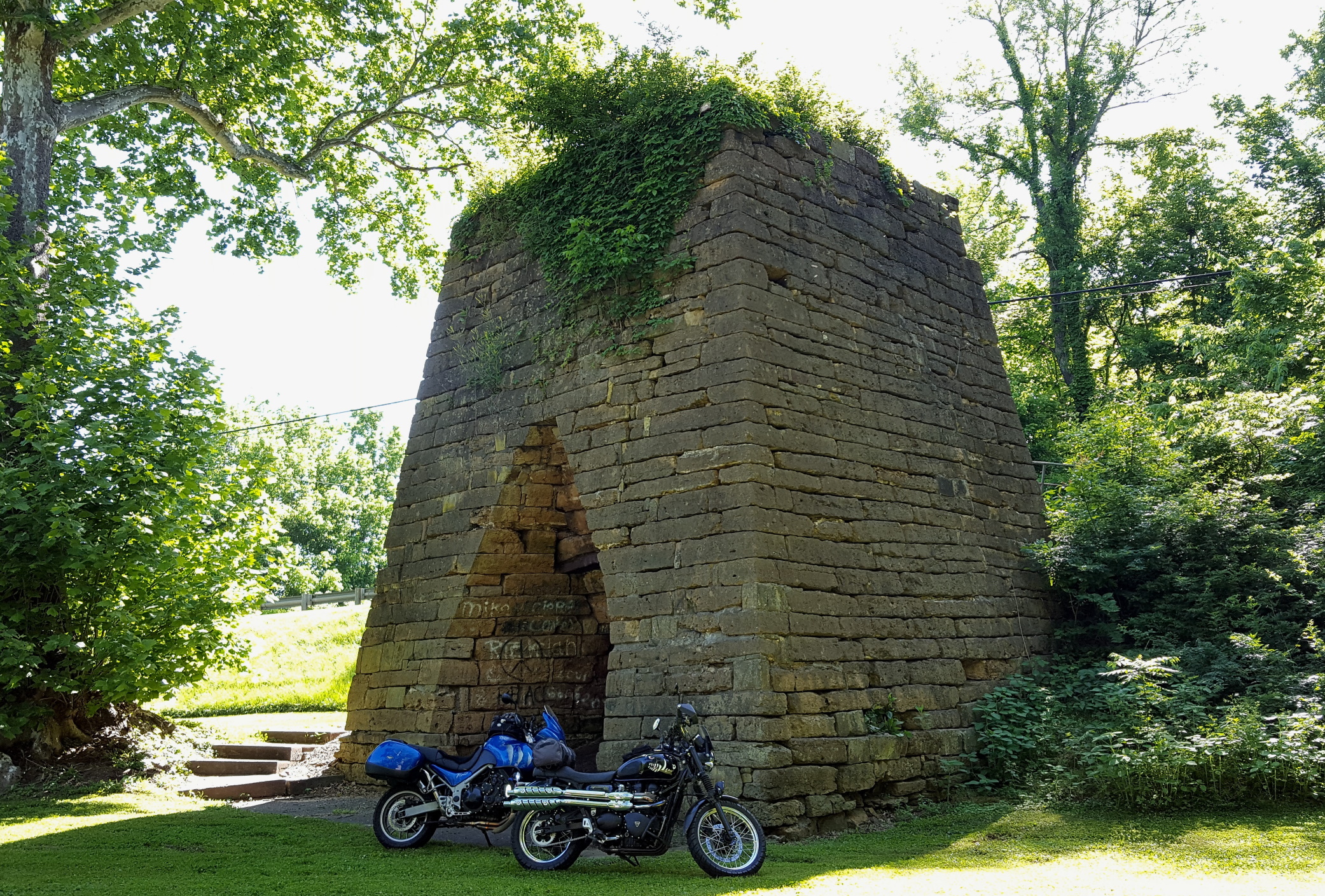
Section 4 starts at the gas station in front of the IGA in Frenchburg and works it way south through Red River Gorge, passing through Slade, and than swings back north through Campton, then ending at a fuel stop southeast of Cave Run Lake. This section is the commuter route that drops riders off at the Daniel Boone Backcountry Byway (DBBB) or the Kentucky Adventure Tour (KAT) depending on where riders are headed. For riders just along for the tour, or headed back north after adventuring on the DBBB/KAT, there are are a few gravel county roads, but the pavement along this section of the route is some of the best to choose from. KY-77 from Frenchburg through Nada Tunnel in Red River Gorge is a must-ride, along with KY-746 and KY-1693 just east-northeast of the gorge. Gas stations are available in Slade and Campton if folks are looking to fill up before leaving or returning to the BRAP from other routes.
Section 5 – 106 miles

Section 5 begins at a Valero Station just north of West Liberty and runs northeast through rural backroads of Elliot County, ending in Counts Crossroads just west of Grayson. This section is highlighted by twisty single-lane pavement and gravel roads that skirt the watersheds that feed Grayson Lake. There are multiple roadside photo opportunities as the route winds along the cliffsides and remote Appalachian hollers; highlights include Wrigley Arch, Lawton Limestone Mine, and multiple scenic creek crossings. Early in this section, adventurous riders can take a detour onto the “Redwine Challenge” section, which adds about 12 miles to the section. The Townsend road hill climb is rocky and especially rutted by 4-wheel traffic and borders between “intermediate” and “advanced” skills levels depending on recent rains and traffic (See terrain ratings here). On the north end of the route, the Lawton Limestone mine is another photo opportunity with an odd history that’s worth looking up.
Section 6 – 103 miles

Section 6 starts at a Marathon Station in Counts Crossroads, Kentucky, just west of Grayson. This section of the BRAP weaves its way north up through some stellar pavement and onto gravel through Carter Caves, and then up to an endless series of remote hollers that mirror the experience in section 1. This section includes multiple photo opportunities, including the rock shelter along Tygart’s Creek, Lauren Iron Furnace, and Bennett’s Mill covered bridge. About midway through the route, there’s a final challenge section through Howe Hollow. This route finishes with a spectacular view of Portsmouth as the pavement descends to the Kentucky riverside on its way back to the Marathon station, where section 1 begins.
The BRAP Shorty
For riders looking for a day or weekend ride, Sections 1 and 6 have been combined into a 170-mile loop that starts and ends at the Marathon in South Portsmouth. This loop includes a gas stop in Grayson about halfway for folks short on range.
Note: The GPX file has a “Shorty Scenic” and a “Shorty Challenge” track, depending on which difficulty you prefer.

