
Where can I get a BRAP Map?
To best experience the BRAP, click the link below to download the latest GPX file. The BRAP was created with Gaia Maps but is compatible with most mobile navigation apps or GPS units. This GPX file includes the 6 section of the route, the challenge sections, the BRAP Shorty (see “how much pavement is there?” below), and waypoints to include fuel, warnings, and points of interest.
How long is a BRAP?
The BRAP is a roughly 600-mile loop, separated into 6, 100-mile sections, with gas stations at the beginning and end of each section. Riders can choose where they want to transition on and off the BRAP as they see fit. For riders that are near the SOAL, there’s also the “BRAP Shorty” included in the GPX file. The “shorty” is a 170 mile loop that goes from South Portsmouth to a gas station in Grayson just after halfway and then back north to the start.
What’s the terrain like?

The BRAP is a traditional “ADV” route, consisting of lesser maintained paved roads, along with gravel and occasional dirt county roads. Roads throughout eastern Kentucky can be steep and include hairpin turns on both gravel and pavement. In drier months, trail conditions should be favorable for novice ADV riders, however, some dirt roads may be slippery after any recent rain. Overall, the route is intended for Adventure-class motorcycles and does include some long sections of twisty paved roads to connect gas stations, historic landmarks, or National Forest areas. “Adventure” tires are recommended, but not required depending on rider skill level. BRAP riders looking for a little more excitement can also try out the “challenge” sections also included in the GPX file. To learn more about trail ratings and off-road skills, check out this article on “How to Measure Adventure Riding Skills“.
Where can I get fuel?
Each section starts and ends at a gas station. In addition, nearby fuel options are also listed as potential waypoint in the GPX file, both along and near the route. Each section ranges from about 90 to 110 miles depending on if you choose to include a challenge section. If your bike range is limited, it would be wise to pack extra fuel in a approved container.
What kind of sightseeing is there?
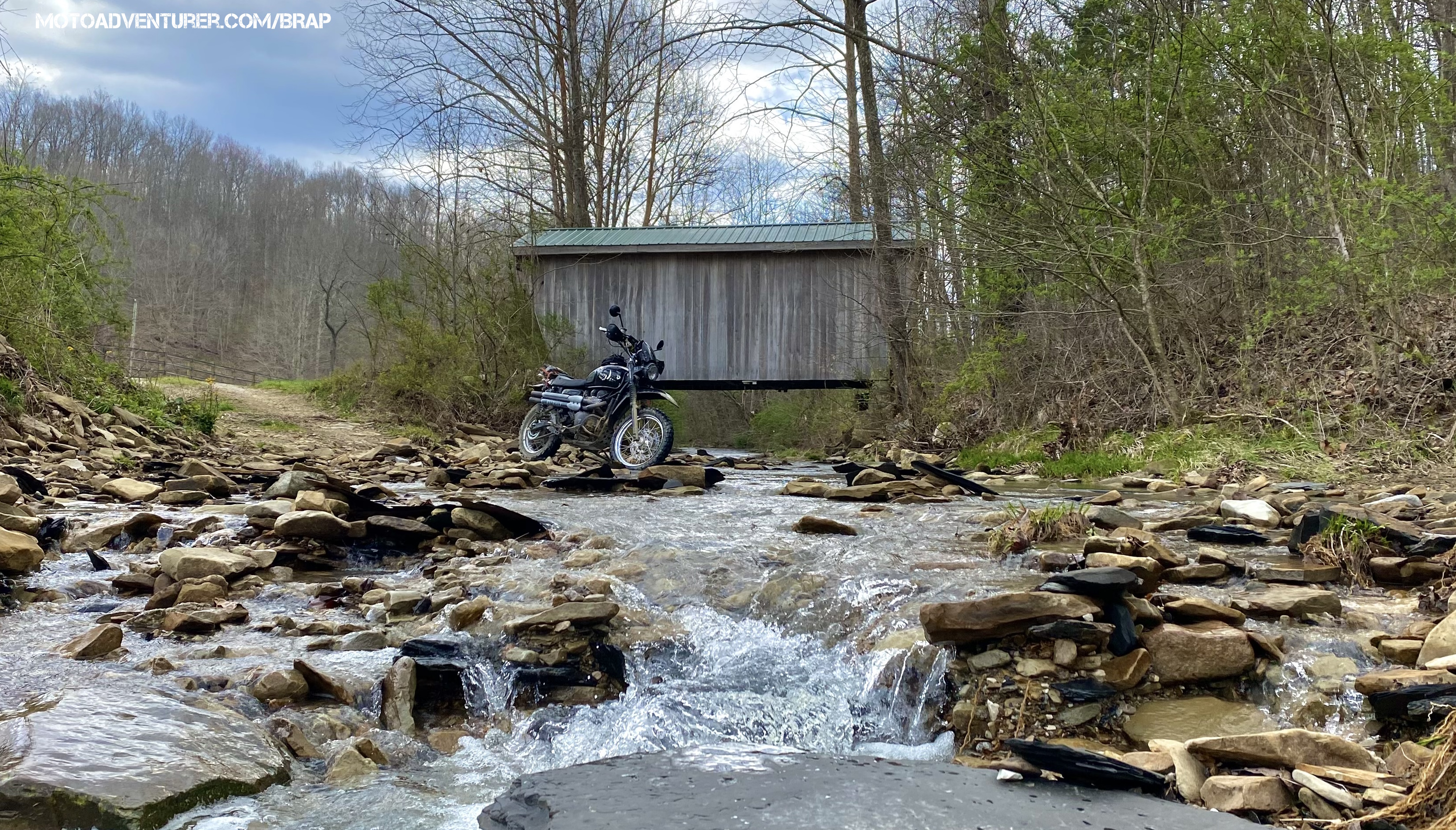
From South Portsmouth to Frenchburg and back, the BRAP passes 4 of Kentucky’s 12 remaining covered bridges (plus 1 modern one), 3 historic Iron Works sites, travels through Red River Gorge, passes near Broke Leg Falls, Sky Bridge, Natural Bridge, Cave Run Lake, Carter Caves, Daniel Boone National Forest, and endless miles of Bluegrass Amish country.
How much pavement is there?
Sections 1 and 6 are very close to 50% off-road vs. on, especially if measured in saddle time. As you travel south in either direction, the stretches of pavement increase. For folks looking to maximize off-road time, the “BRAP Shorty” is your best bet. For folks commuting between South Portsmouth and Frenchburg-Slade, lean back and enjoy the scenery. Check out the route description page for more details.
Where is camping or lodging along the route?

- Near the start of section one, Shawnee State Park Campground is located just across the river in southern Ohio.
- The Worthington Lodge is located in Blue Licks Battlefield State part just west of Flemingsburg at the end of Section 2.
- Clear Creek Campground toward the end of Section 3 near Frenchburg is a Daniel Boone National Forest campground, coincidentally adjacent to Clear Creek Iron Furnace.
- Section 4 passes by numerous lodging options due to it’s proximity to Red River Gorge. Callie’s Campground, Lil’ Abner’s Motel, Whittleton Campground, Hemlock Lodge, Miguel’s Campground, and endless AiBnB opportunities.
- Carter Cave’s State Park is available in the south end of Section 6 just west of Grayson and conveniently located shortly from I-64.
