

With the long weekend at hand, the weather cooperated and I finally had a chance to head south to see family, while at the same time enjoying one of my favorite motorcycle rides. As previously mentioned, I make at least one trip to the Red River Gorge area each year; eastern Kentucky is really right in our backyard from southwest Ohio, so I jump at any opportunity to get down there. This first trip was more about seeing family than it was about taking in the sights, but I brought along the new GoPro anyway.
Since visiting took priority over adventure, my Dad and I took OH State Route (SR) 73 out of Dayton down toward Hillsboro to stop in to see my Uncle. 73 is mostly 2 lane, including a few stop lights, but I would consider it to be one of the better state routes leaving Dayton from the “scenic” perspectives. 73 isn’t the twistiest road, but it gets better as you leave Hillsboro headed toward Portsmouth. From Hillsboro my plan was to use SR 41 to skip over to SR 125 in order to ride SR 763 to the river. Friends have told me that 763 is one of the best roads near Dayton/Cincinnati if you like the twisty stuff. 41 out of Hillsboro is actually pretty decent, there are several sections that parallel some local creeks which made for good riding. 125 is also quite scenic from Portsmouth to West Union, however we were headed west out of West Union to get to 763, where 125 is relatively straight.
 Finally turning on to 763 I was ready to film the stretch in full length after what I had heard. Suddenly the mood was dampened as I passed a sign reading “Road Closed 0.8 miles ahead”. As friends of mine will attribute, I occasionally treat “Road Closed” signs more like “Caution: Slow” signs. More often than not “Road Closed” is still “open to local traffic only” meaning that the road is passable, just under construction. I don’t have a GPS on the bike (Cell phone only), therefore searching for an alternate route involves stopping most of the time, so I’m known to take is slow and just plow through. That however was NOT in cards this weekend, as “Road Closed” meant “BRIDGE IS OUT!” Apparently 763 will have to wait for another adventure.

Having been shut down by the Ohio Department of Transportation, we headed back south via SR 41., while not amazing, 41 got better as we neared the Ohio River. 41 dead ends into US 52 on the Ohio River in Aberdeen, from there we took the US 62 bridge across the Ohio River into Maysville, Kentucky. Time permitting, I plan on returning to Maysville later this year to try out some of the local food; I don’t know if it’s a Cincinnati thing, or just an “adventure” thing, but I love stopping in river towns to take photos and try the local pub fare.
 In east Maysville we picked up Kentucky Route 11 (KY 11); from there it’s usually 11 all the way through Mount Sterling KY, then US 460 to Frenchburg where my Grandma lives. KY 11 is two lane highway for the most part, but considering Kentucky elevation changes, there are sections of “truck lanes” so you can pass slower traffic when headed up hill.
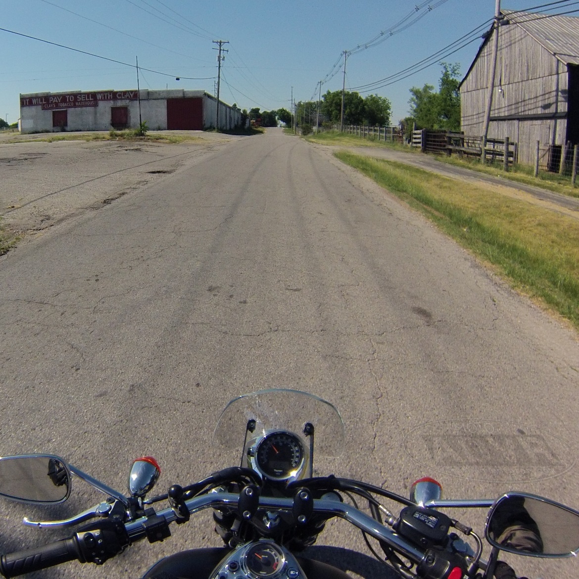
  11 is typically 55 mph through gentle rolling hills from Maysville to Mount Sterling, which is pretty much what I envision anytime someone says “the Bluegrass State”; two lane highway lined with grass blowing in the wind, barbed wire fences, livestock, and sprinkled with hay bales, silos, and tobacco barns.
Last year when I was planning a Red River Gorge ride, a buddy of mine pointed out an alternate route which I actually prefer now. Just after Sherburne Kentucky I take KY 1106 east off 11 headed toward KY 36. 1106 is arguably one-and-a-half lane highway through the boondocks, for a motorcyclist, it’s fabulous. 1106 sweeps through the hills and skirts several creeks as it merges with KY 36.  36 is more of the same from Sharpsburg to Owingsville. Unlike Mount Sterling (which is on 11), Owingsville is essentially a one-stoplight town, probably worthy of a visit sometime when I’m drifting about. Out of Owingsville 36 crosses Interstate 64, after which the Appalachian foothills start to appear. 36 enters Daniel Boone National Forest not long after passing I-64, where it stays all the way into Frenchburg. As you near Frenchburg 36 starts to carve through the limestone foothills which starts to make for good photos.
 Frenchburg, County seat of Menifee County, really is a one stoplight town. On a Red River Gorge tour I typically stop at the Subway across the street from the courthouse for a sandwich and a bathroom break before getting into the twisties. There are a couple “Mom & Pop” restaurants, an IGA, and couple gas stations, but it’s essentially another sleepy Appalachian town. From here my Dad and I cut down the county roads to my Grandmas house hiding back in the Holler. For folks looking to see Natural Bridge, Sky Bridge, Nada Tunnel, and the rest of Red River Gorge, I recommend taking US 460 from Frenchburg to KY 77.
  77 sweeps along the ridge and through the limestone cliffs to Nada Tunnel, then on to KY 11 in Slade, Kentucky. From Slade you can take 11 over to Natural Bridge, or KY 15 to KY 715 to see the Sky Bridge. If things go as planned, I’ll take you on a tour later this summer, photos included. In the meantime, I’ll leave you with a few photos from this weekend and a few from years past.


This post makes me miss the east.
LikeLiked by 1 person
I love Appalachia. I don’t know if I could ever convince my better half to move but my heart is undoubtedly in dixie.
LikeLiked by 1 person
I just remembered stopping at Broke Leg Falls on a ride last year.
LikeLiked by 1 person
Pingback: Destination Bourbon Country: Ride to Woodford Reserve Distillery | Moto Adventurer
Pingback: Triumph Dragon Raid 2015: Day 0 – Southbound (Part 1) | Moto Adventurer
Pingback: Appalachian foothills in the Bluegrass State | Moto Adventurer
Pingback: Destination State Route 763: Twisty Roads in Southwest Ohio | Moto Adventurer
Pingback: Destination Red River Gorge: Moto-Camping and New Roads | Moto Adventurer
Pingback: Setting Goals for 2017 | Moto Adventurer
Pingback: Updating the Moto Bucket List for 2019 · Moto AdventurerMoto Adventurer