
 For frequenters to the blog, it goes without saying that I venture into the Bluegrass State on a regular basis, Red River Gorge more specifically. On an “Off-Friday” (18 NOV), a buddy joined me on what was his first trip down to the gorge. This is the same buddy that showed me around Shawnee a few weeks back, so scouting out some local dirt roads around Menifee and Powell County was undoubtedly on the docket along with the usual highlights.


After accolades of my “scrambler adventures” reached the secure confines of Facebook, my uncle sent me a text, suggesting that I go take peek at a nearby road from Grandma’s house.  Not to be threatened with a good time, that took top priority after stopping in Frenchburg to top off the tank. Hatton Ridge Road spurs off from Kentucky Route 713 (KY-713) at the most dangerous curve, hands-down, I’ve ever seen anywhere (blind, off-camber, 90-degree curve; did I mention there’s gravel?). This time around, instead of negotiating said curve, I was actually intentionally headed into the gravel to see this nearly forgotten un-improved road. Hatton Ridge Road takes a hard left at Spas Creek (more on that in a minute), and heads south on maintained gravel to a local cemetery, before turning into double track down to the end of the ridge spur. Unfortunately photos can’t do it justice, as most of the local roads carve along creek-beds (which isn’t a bad thing), from the top of the ridge you get great views through the trees of the gorge below.


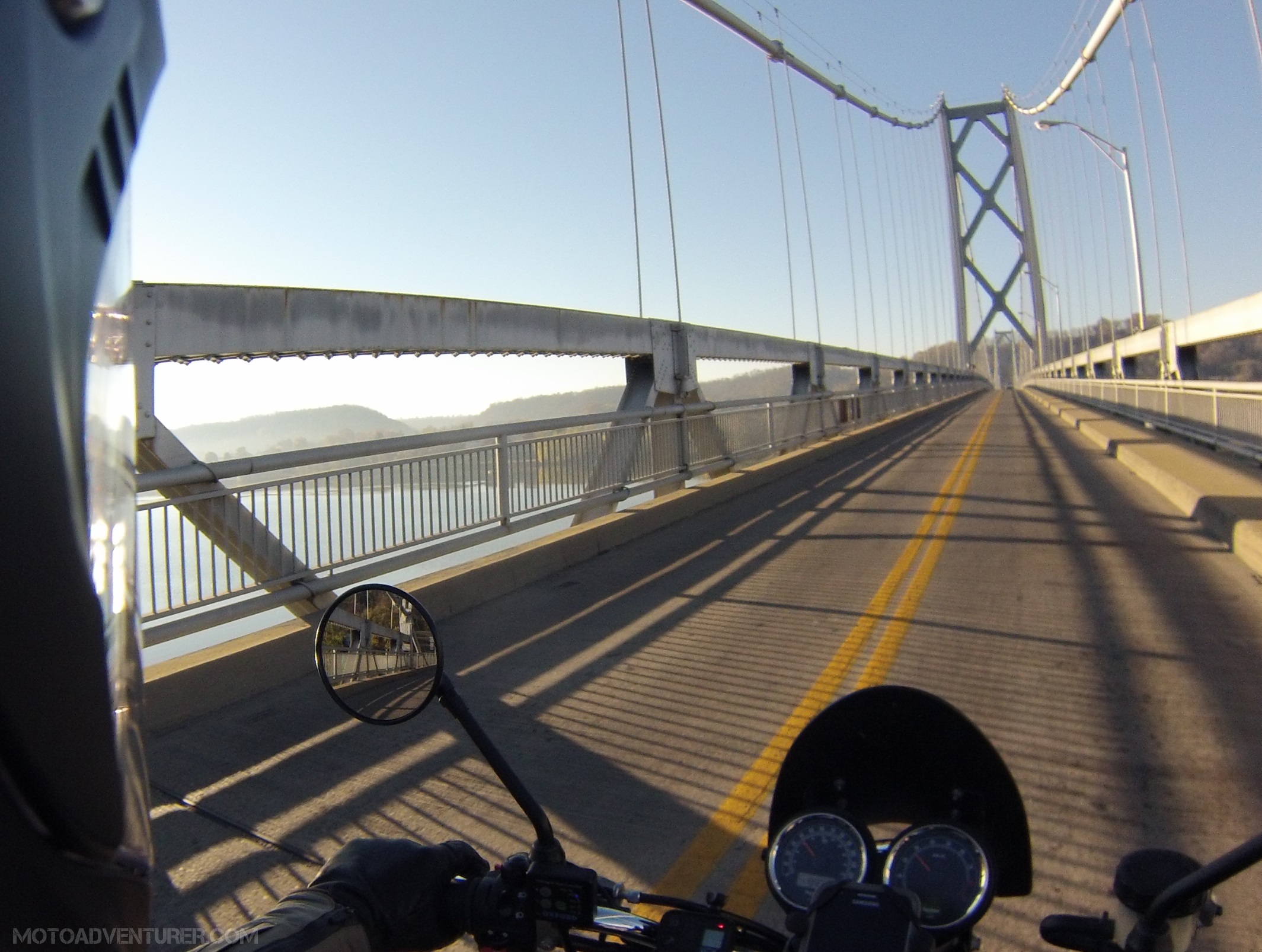
After a down and back across Hatton Ridge it was time to do a little sightseeing at my favorite Red River Gorge destinations, KY-77, Nada Tunnel, KY-15, KY-715, and Sky Bridge.


After grabbing a sandwich and catching the lofty views of the gorge from Skybridge, we went back to exploring more roads I’d not seen before. 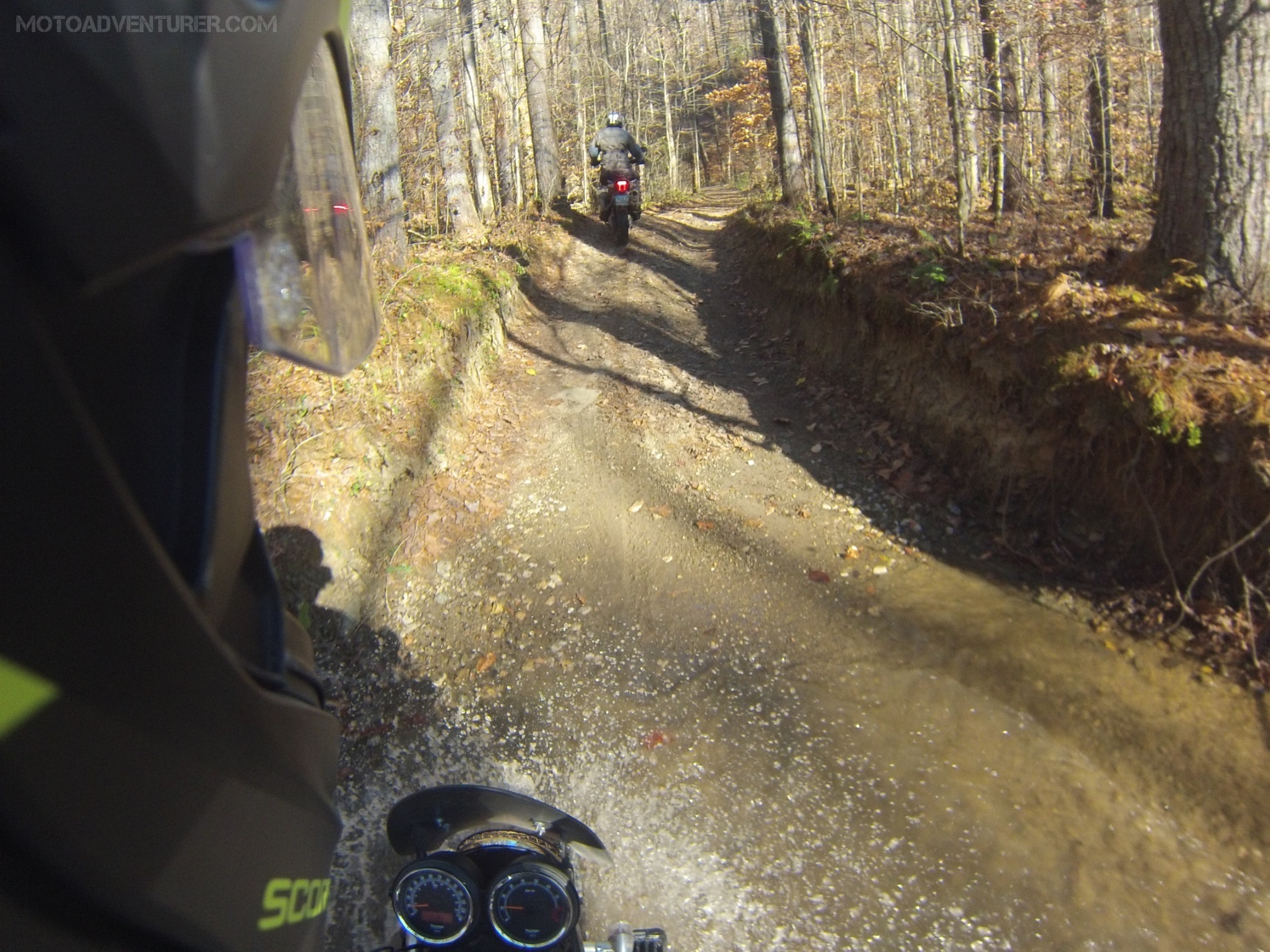 The night prior I scanned over a short thread on ADVrider about local dirt, after which I figured we should go take a peek at the south end of Spas Creek Road. Based on what I could see on Google maps, and from the little bit I caught on ADVrider, I assumed that at some point we would come across an impassible section and be forced to turn back. Like Hatton Ridge, Spas Creek started out as dusty but well maintained gravel. After about two miles that gravel rapidly deteriorated into sloppy double track littered with deep puddles and several creek crossings. After a series of obstacles, getting off the bike to make a plan, mounting back up to negotiate another obstacle, only to find a more challenging hurdle immediately thereafter.
 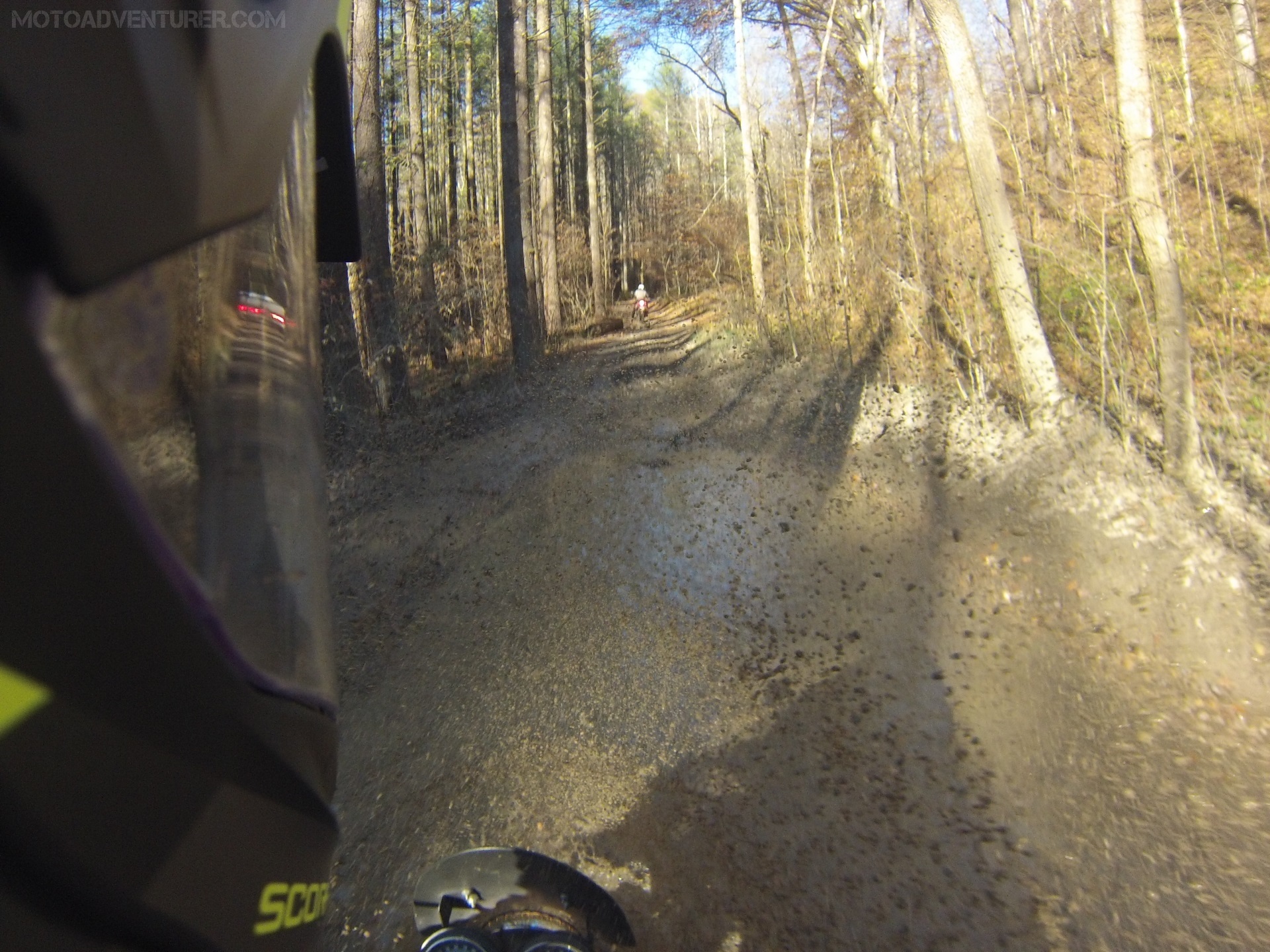 This turned out to be the toughest test of the Scrambler, and certainly myself, thus far. Street tires and excess weight became extremely evident when the mud got sloshy and the ruts just got deeper. At some point we decided to call it, not knowing if the road was passable to the top, considering two fat street bikes and my amateur off-road skills, at some point we figured we were pushing our luck in attempting to go back through a series of nasty ruts twice.


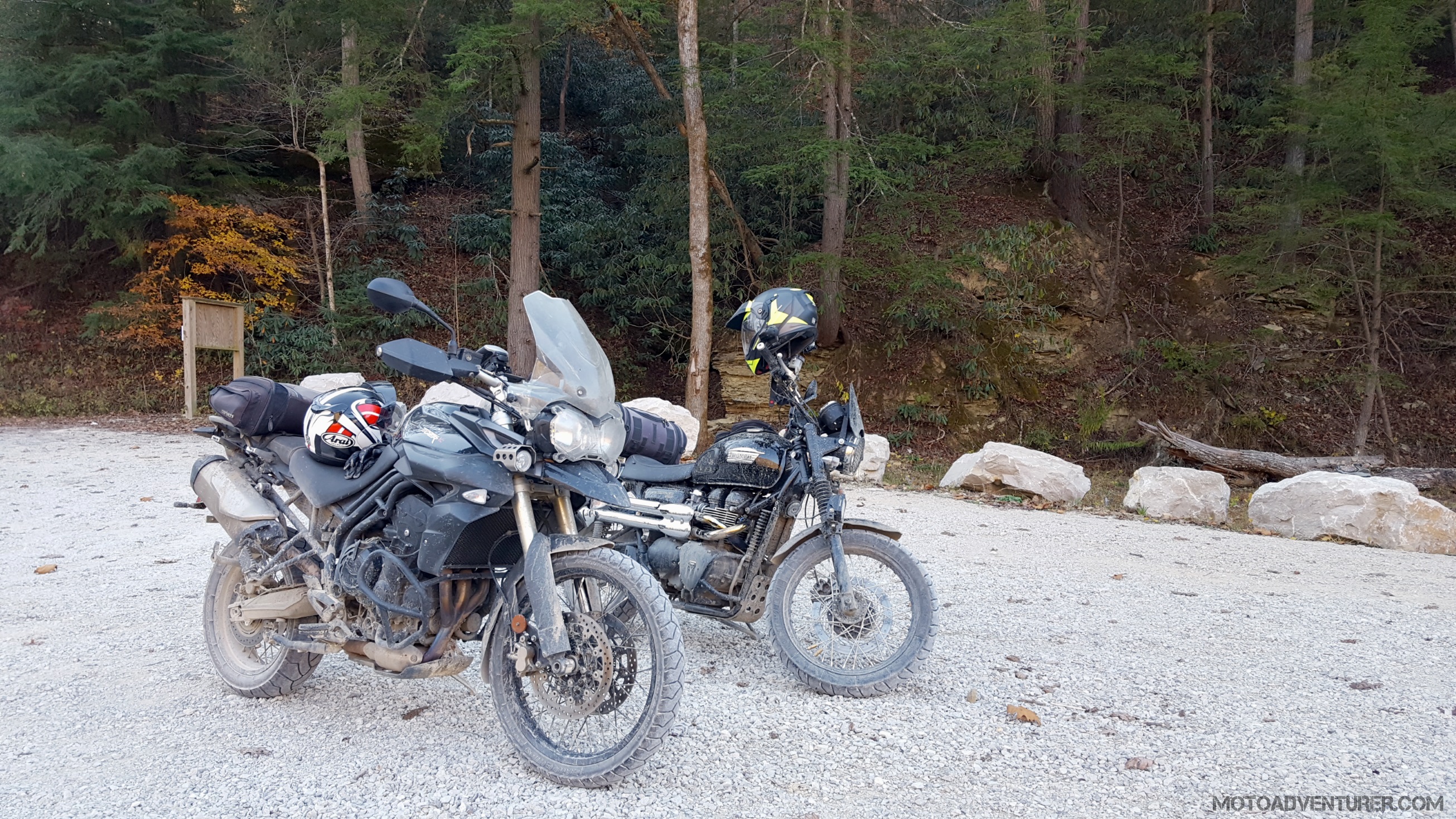
 From Spas Creek, we decided to take a short (desolate) section of KY-615 over to Indian Creek Road. True to what I read on ADVrider, Indian Creek turned out to be a bit tamer than Spas Creek, albeit a bit more maintained than I prefer. We road down to another creek crossing, where, for whatever reason, the park service had the road closed. After taking a short break, tossing water on my mud caked oil cooler, the sun started to dip behind the hills and it was time to call it a day.


 Despite being one the verge of dumping my “shiny new” bike in some precarious mud puddles, that mile stretch of nastiness was probably the best ride of the whole day; truly adventure I’ve never encountered anywhere else. I have a strange feeling that one of these photos may find its way up onto the Moto Bucket List now that I have confirmed that Spas Creek does in fact connect to Hatton Ridge (big thanks to an avid 4×4 off-roader @maynard032 on Instagram).

You are not helping my Scrambler lust…
LikeLiked by 1 person
Exactly! I was trolling ADVrider a lot before I bought… just fueled the fire!
LikeLiked by 1 person
You should bring it to the 2017 Indy Mad Max run!
LikeLiked by 1 person
That’s my plan this year! Hopefully the weather is better.
LikeLike
Yeah, it was a bit wet this year! I’m bikeless until 2018, so I’ll be riding in my buddy’s Ural. Hope to see you there!
LikeLiked by 1 person
You can man the fun turret then!
LikeLike
Looks like some fine riding. Wish we had some curvy roads like that around here. Gonna have to make a trip to the northern part of SC sometime soon. Ride safe.
LikeLiked by 1 person
Kentucky is awesome, I find new stuff almosy every time I go down. Same sentiment here though, most of Ohio is flat or busy, fortunately it’s only a 2 hour ride south! Is it still warm down there?
LikeLike
Pingback: Setting Goals for 2017 | Moto Adventurer
Pingback: Route Planning: A Petition to Google | Moto Adventurer
Pingback: Rever, Ural Motorcycles, and the #WinterBeDamned Challenge | Moto Adventurer
Pingback: Daniel Boone Backcountry Byway and the Kentucky Adventure Tour: Updating the Moto Bucket List | Moto Adventurer
Pingback: Triumph Scrambler Project: Stage 2 Upgrades | Moto Adventurer
Pingback: The Daniel Boone Backcountry Byway: Triumph Scrambler Adventures | Moto Adventurer
Pingback: Red River Scramble: Adventure Meetup in Red River Gorge | Moto Adventurer
Pingback: Tried and True Dual Sport Tires: Shoe Shopping with Rosie the Scrambler | Moto Adventurer
Pingback: Red River Scramble: Where to Ride | Moto Adventurer
Pingback: Triumph Scrambler Adventures: Day Trip to the DBBB | Moto Adventurer
Pingback: Red River Scramble 2018: The Bluegrass Adventure Rally | Moto Adventurer
Pingback: Auxier Ridge Trail: Red River Gorge | Moto Adventurer
Pingback: Red River Scramble 2018: The Bluegrass Adventure Rally | Moto Adventurer