
While I originally had intentions of returning to the Indy Mad Max Run this year, I also had a long standing invite from a buddy of mine to get down to Kentucky to go ride some “adventure roads”. The weather wasn’t looking particularly good in Ohio and Indiana last weekend, so I decided I’d rather return to “The Mother Land”, especially after getting all the new goodies bolted on the Scrambler.
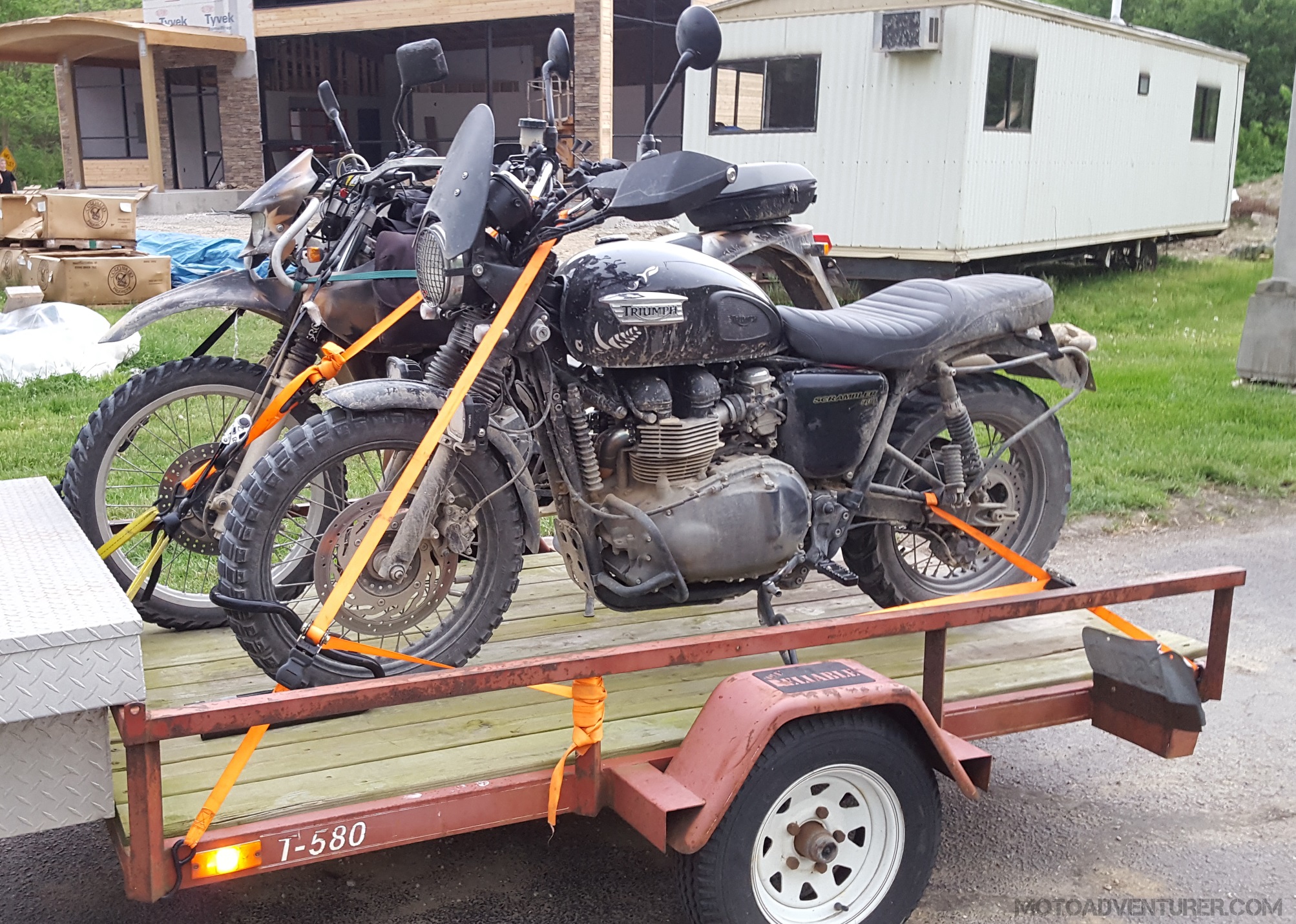 Way back when, I borrowed a saying from a buddy of mine, “If you see my bike on trailer, call the police… because it’s stolen!” While I wish I could always live by that mantra… there are advantages to having a trailer. In this case, literally moments after I loaded Rosie onto my buddy’s trailer, the heavens opened up. Again, I’d prefer a scenic backroad to the Bluegrass State, but moments after driving onto the freeway, it looked like it was on the verge of hail, so the extra 2 hours of riding time would be a fair exchange for a trailer ride.
Once in Kentucky the skies started to clear and we even got a little sunlight before we set out.  After grabbing a quick sandwich, we decided to tackle as much of the Daniel Boone Backcountry Byway (DBBB) possible before it got dark. Leaving from Slade and running counter-clockwise as the DBBB flier suggested, that put my arch nemesis, Spaas Creek Road, at the front of the line.
Spaas Creek Road
Considering all of the rain that the tri-state area had received in the previous weeks, I was significantly intimidated by the potentially deep ruts through the mud I expected to find on Spaas Creek. It was extremely dry last November, yet Spaas Creek road was still loaded with ruts and mud pits because of the shaded creek valley;  I expected much worse with the wet spring. Passing the last signs of civilization for the next few hours, it was merely a few mud puddles and a creek crossing before I found myself standing at the edge of the muddy, rut filled, quagmire that stopped me in my tracks back in November. Considering all of the new trinkets on the Scrambler, I hoped I would fare better than before, but after watching my buddy Tom, on his MZ 660 Baghira (a much more dirt worthy machine) slide up a rut sideways, I was debating an alternate route. After looking over the soupy mud bed, envisioning my scrambler laying half buried in the sludge, I decided it best to “bushwhack” my way past the muck and “live to fight another day”.
 Past the mud-hole-minefield, new obstacles continued in succession; while I didn’t keep count, I would say there are over a half dozen creek crossings down that road. In fact, I actually found that crossing the creek was easy, it was the mud pits dug by the four-by-fours that proved the most difficult. I watched Tom sink up to his knees several times as a rut hidden under the water got significantly deeper at the far end of the “puddle”. He kept saying “creek crossings… I can’t tell when it’s the creek and when it’s just a mud puddle” as most of the “puddles” were larger than the creek in most places.
Over the winter I caught a video including extended sections of the road that were actually in the creek, perhaps as long as 300 yards.  The videos also showed some significantly high water, fortunately for us, the water level was quite low, despite all the recent rain, much to my relief. After a long stretch of riding up the creek bed, we passed a short waterfall and finally the turn that led to the final ascent out of the valley. At that point I was starting to feel a sense of relief and accomplishment, assuming it was a dry gravel road to the end, that feeling was short-lived.
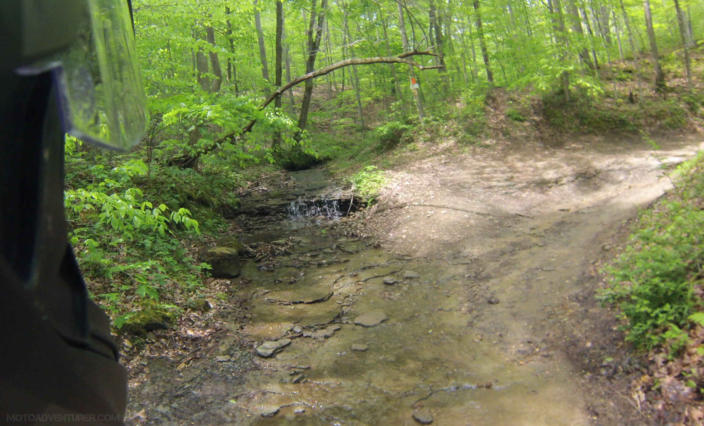 Halfway up the climb, I arrived at a “shelf” with another ominous, water filled, jeep rut, adjacent to a steep drop-off into the ravine on the right. I watched Tom take another deep “dunk” into the puddle which left me to “thread the needle” through the opposing rut while not falling to my death. Like a champ, Rosie delivered again and moments later, exhausted, were standing at the top of Spaas creek at Hatton Ridge road, a “mini” bucket list item completed.


Pumpkin Hollow Road
Having survived Spaas Creek in one piece, I was pumped to attack the next section. Until now, I’ve been unable to pin down precise pictures of Pumpkin Hollow Road, so I was unsure of the conditions. From what little I could see on satellite photos, I was under the impression it was at least mostly dry… or so I thought. Coming off the pavement of KY-713, we made a left on a double track gravel road that, if not for the large DBBB sign posted at the intersection, looked like an inconspicuous private driveway. “Out of the skillet and into the frying pan” as they say, I traded the creek and otherwise wet muck for loose dirt, stones, and steep inclines. The assent back over the ridge and into the gorge was of equal magnitude of the tail of Spaas Creek, but it was heavily rutted from the four-wheel-drive traffic.
 I goosed the Scrambler a bit to get through some of the loose gravel, trying to keep momentum as to not slip into a deep rocky rut, yet I rapidly found myself with one wheel stuck in each rut and the skid plate resting on the “hump”. Rosie sat there, “stuck”… mocking me… I naturally stepped off the saddle and took the obligatory photo. I slipped the clutch, wrestled, man handled, and bulldozed my way down and back up a ten yard section of the hill (and both ruts…) and finally made it to the summit where Tom sat waiting. One the far side of the ridge Pumpkin Hollow also takes a creek excursion through the woods as it approaches KY-599 where we returned to the tarmac.


Chop Chestnut Road
I’ll have to hand it to the “planners”, the DBBB just keeps throwing unique challenges at you, as no two roads are the same.  I assumed the rock quarry was going to be a dusty mess, but that mess was brief as we found the nearly abandoned north section of Chop Chestnut road. Once up on the ridge, the gravel roads faded away to “forest floor” double track. Meandering thought the woods I got the sudden feeling like my front tire was going flat, a new challenge I was not looking forward to tackling, but as it turns out, it was actually an inch thick layer of sand that was creeping up in various turns and gullies. I’ve heard a lot of riders say it, and I agree, sand sucks… However, the unique view of the ridgeline and the sandstone boulders made up for the goofy front end “feel”.
  It did however make some of the incline obstacles incredibly challenging; attempting to get up the face of a steep “hill” (essentially part of the sandstone mountain), I needed to carry some momentum to keep from sliding down the sandy slope; on top of that slope was obviously another thick patch of sand so I “nerfed” the turn a bit to keep from washing out the front end. That whole “look where you want to go” thing played its hand and I had an impromptu meeting with tree stump. Fortunately, the Scrambler’s 19” front wheel just coasted up the embankment without catastrophe; I backed down the slope and headed on my way. The sand beds began to disperse as were neared the intersection with KY-3354; but not before revealing a series of “steps” in the sandstone boulders. My buddy Tom took the left fork down the “steps” and immediately told me over the headset to take a look at the right fork before taking the Scrambler down a significant drop-off; fortunately, the right fork was mostly a downhill sandstone washboard.
Mountain Springs Road (Under Dispute)
After tackling the sand and boulders it was a short trek down the “hardball” toward Mountain Springs and Furnace-Pilot Road. In preparation to tackle this Moto-Bucket List ride, I have been keeping up with the DBBB on Facebook along with the Kentucky Adventure Tour (KAT) thread on ADV Rider as the two overlap in the north section. From what I’ve seen on both forums, there appears to be a dispute regarding public travel across Mountain Springs Road. Apparently a local land owner has a differing opinion on whether or not the road is public; a situation that is being debated in court… although the case has dubiously been delayed several times for whatever reason.
 Knowing this, I full well expected to roll up on the before mentioned property to find a closed gate and a “dead end”. As it turns out the gate was open, but the land owner was just then “walking up” on horseback and informed us it was “private property”. We had a short, friendly, exchange; in a non-Appalachian accent, she also informed me that I would likely tear up my motorcycle if I went down that hill… Tom and I subsequently decided to roll back up the road and go around rather than escalate the existing tensions about the roadway.
As of this writing, last night the Estill County Court ruled that at least one section of the Mountain Springs road will remain open to public travel, however there is an additional court case regarding another section of the road.
Fixer Leeco Road – Fixer Road – Cave Fork Road
After the long detour around Patsey, we were finally back on the designated DBBB route and headed down Fixer Leeco Road. Needless to say I’ve been searching for off-road opportunities in the Red River Gorge area for some time now. During that research I discovered “The Narrows Road”, and learned about the former oil business west of the Natural Bridge area. The Narrows Road is unfortunately closed to motorized vehicles now, but Fixer Leeco Road runs through a very similar area (although not on top of a cliff). Fixer-Leeco Road and subsequently Fixer Road are again another flavor of Appalachian primitive roads, reminiscent of Shawnee State Forest in some ways.
  Fixer road included a large number of creek runs and creek crossings, perhaps not as numerous as Spaas Creek, but the water levels were indeed higher. Aside from the country view, the remnants of the oil industry also added to the experience in this area. It was also obvious there were many adjacent trails to the DBBB as we encountered a series of off-road “Side-by-sides” as we neared the junction with Kentucky Highway 11.


As we rolled back onto pavement around 6 PM, Tom and I decided to head back toward Slade as we didn’t have time to complete the last off-road section along Devil Creek.
 However, with a bit of daylight remaining, I suggested we take a detour up to Chimney Top Rock to get a good sunset view of the gorge before hanging it up for the day. I have obviously talked about riding up to Sky Bridge in the past, but after my recent off-road interests, I have begun exploring the gravel trail-access roads throughout the gorge. Off KY-715 (Sky Bridge Road), there’s a three mile gravel spur that takes you up to arguably one of the best views of Red River Gorge.
  Following a short (1,000 yards) walk from the parking area, Chimney Top Rock offers a 270-degree view of Red River Gorge including Halfmoon Rock, Hanson’s Point, Pinch-Em Tight Gap, and the Red River. No sooner than Tom and I stepped off the bikes, we heard the ominous clap of thunder. I wasn’t going to ride all that way and miss the view, so we hustled out to the point for some obligatory photos (including some storm clouds) before getting back to the trailer.


In the end, I can’t consider this Moto-Bucket List item complete, with a name like “Devil Creek”, there’s undoubtedly more challenges in my path. That said, I was impressed time and time again by the Scrambler’s capability in some of the most adverse conditions. Undoubtedly, I owe a lot to a good set of knobby tires and suspension upgrades; but that aside, there’s no denying that Triumph has built a sturdy tractor. No sooner than I had cinched down the last ratchet strap, rain drops falling, I was already day dreaming about my next venture down unimproved Kentucky backroads.


I think the DBBB is telling you that you MUST to go CLOCKWISE, because all of their signs tell you to go RIGHT.
LikeLiked by 1 person
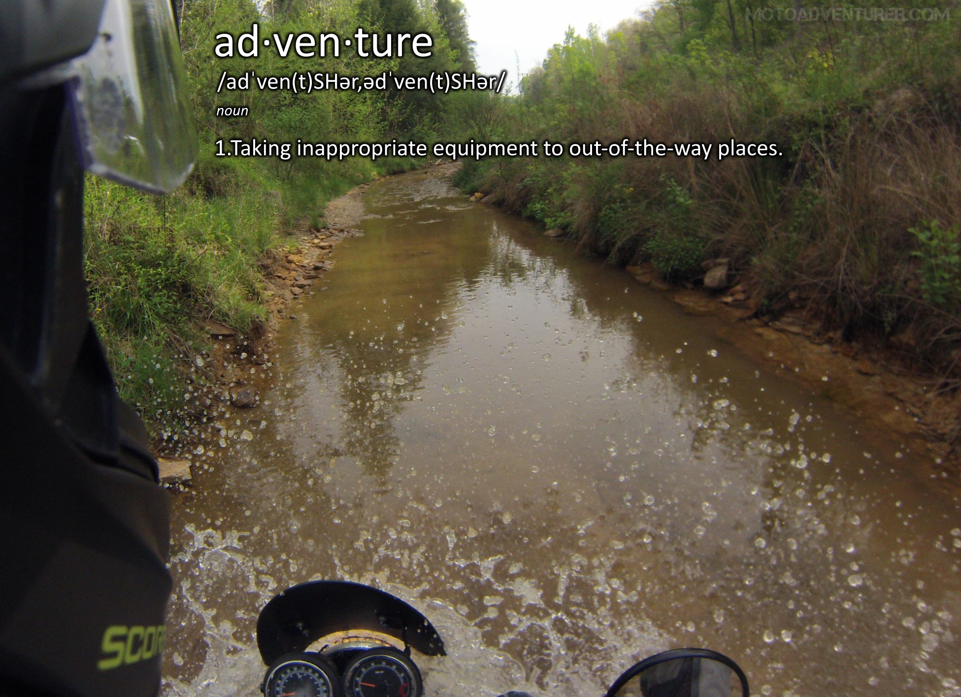
looks like you had quite the adventure. I like the opening definition of adventure:”taking inappropriate equipment to out of the way places.” Another favorite of mine is, “an adventure is an ill planned trip.” Nice post.
LikeLiked by 1 person
Good call Bob! When the plan goes awry the Adventure begins!
LikeLike
Pingback: Red River Scramble: Adventure Meetup in Red River Gorge | Moto Adventurer
Pingback: Riding Your Motorcycle Everyday: Reflections on 90 Days in the Saddle | Moto Adventurer
Pingback: Tried and True Dual Sport Tires: Shoe Shopping with Rosie the Scrambler | Moto Adventurer
Pingback: Red River Scramble: Where to Ride | Moto Adventurer
Pingback: Red River Scramble: 160 Days in the Saddle | Moto Adventurer
Pingback: Triumph Scrambler Adventures: Day Trip to the DBBB | Moto Adventurer
Pingback: Goals for 2018: Updating the Moto Bucket List | Moto Adventurer
Pingback: Triumph Scrambler Project: Off-road Rally Planning | Moto Adventurer
Pingback: Red River Scramble 2018: The Bluegrass Adventure Rally | Moto Adventurer
Pingback: Red River Scramble 2018: The Recap · Moto AdventurerMoto Adventurer
Pingback: Conserve The Ride 2018: New Friends and New Adventure · Moto AdventurerMoto Adventurer
Pingback: Goals for 2018: Updating the Moto Bucket List · Moto AdventurerMoto Adventurer
Pingback: Red River Scramble 2018 | Red River Scramble
Pingback: Daniel Boone Backcountry Byway: An Adventure Guide · Moto AdventurerMoto Adventurer
Pingback: Red River Scramble: 160 Days in the Saddle · Moto AdventurerMoto Adventurer
Pingback: 14 Reasons to Start Adventure Riding | Moto Adventurer